Hill Running in Paris: Every Climb Worth Your Legs
Paris is flatter than its reputation suggests — but its hills are real, concentrated, and surprisingly useful for training. A complete guide to elevation running inside the Périphérique.
Paris has a reputation as a flat city. That reputation is mostly true and entirely misleading. The city's average elevation is around 35 metres and most core arrondissements are genuinely flat. But Paris sits in a basin with rims: Montmartre to the north, Belleville and Ménilmontant to the northeast, the Montagne Sainte-Geneviève in the 5th, the plateau of Vincennes to the east. These are not Alpine climbs — the highest point in Paris, the rue du Télégraphe in the 20th, sits at just 128 metres. But for a runner doing hill repeats mid-training-block, the difference between the flat 7th and the 20th is the difference between a recovery jog and a hard workout. Here is the full map of what actually climbs inside the ring road.
Montmartre: the obvious one, and the best
The Butte Montmartre rises about 65 metres above the flat over 400 to 600 metres of horizontal distance, giving sustained gradients of 10 to 15 percent on the steepest faces — steeper than most race courses. The classic runner's route is the rue Lepic: about 550 metres from the boulevard de Clichy to the Place du Tertre, gaining around 60 metres, with alternating asphalt and cobble. Shorten your stride on the cobble sections rather than fighting them. The staircase route up the rue Foyatier — 237 steps from the Place Saint-Pierre to the Sacré-Cœur — is used by local running clubs for stair intervals early Saturday mornings. Three rounds of stairs plus two rounds of rue Lepic is forty-five minutes of hard vertical work without leaving the neighbourhood. Descend via the rue Caulaincourt on the north side, which drops more gradually and lets you run down properly.
The practical problem with Montmartre at any hour except very early is people. Go before 7 a.m. on weekdays or before 8 a.m. on weekends for focused repeat work. The reward: the Paris basin from the Sacré-Cœur parvis at 6:30 a.m. in June, light catching the rooftops, lone open café at the bottom, is genuinely one of the best things this city offers runners.
Belleville, Ménilmontant and the 20th: the underrated circuit
The northeastern rim — the 20th and the borders of the 11th and 19th — is the most useful hill circuit for training that most Parisian runners never discover. Rather than a single butte, you have a series of ridges and ravines running north-south, with streets that climb, plateau, drop and climb again. A five-kilometre loop through Ménilmontant and Belleville accumulates 80 to 90 metres of elevation — more vertical than the equivalent on Montmartre, because the terrain makes you climb in stages.
The spine is the rue de Ménilmontant and the rue de Belleville, parallel about 400 metres apart on either side of the ridge. Connect them with cross streets and you create 300 to 500 metre climbs at 6 to 10 percent — enough to elevate heart rate without destroying legs, perfect for tempo-pace hill work. The Parc de Belleville at the summit gives you a flat 400-metre recovery loop and a long view west. From Belleville it is easy to extend to the Parc des Buttes-Chaumont — 1.5 kilometres north — with its own brutal 30-metres-per-kilometre loop. A combined session: two hill-repeat sets on the rue de Ménilmontant, recovery jog to the Buttes-Chaumont, two loops of the park perimeter, return via the rue de Crimée. Nine to eleven kilometres, 120 to 140 metres of elevation, sixty to seventy-five minutes.
The Montagne Sainte-Geneviève and the Left Bank
The 5th arrondissement ridge — from the Luxembourg westward to the Panthéon and east toward the Jardin des Plantes — is gentler: 4 to 7 percent over 300 to 500 metres rather than Montmartre's 10 to 15. But the density of good surface — wide sidewalks on the rue Soufflot, the rue Gay-Lussac, the rue d'Ulm — makes this the best hill circuit for progression runs or adding climbing to a flat long run.
The practical loop: start at the Luxembourg gates on the rue de Vaugirard, run south on the rue d'Assas to the boulevard Raspail, climb east to the Panthéon, descend north on the rue Soufflot, repeat. Each circuit is about three kilometres and gains approximately 30 metres. Four circuits gives twelve kilometres with 120 metres of elevation in a very contained, safe area.
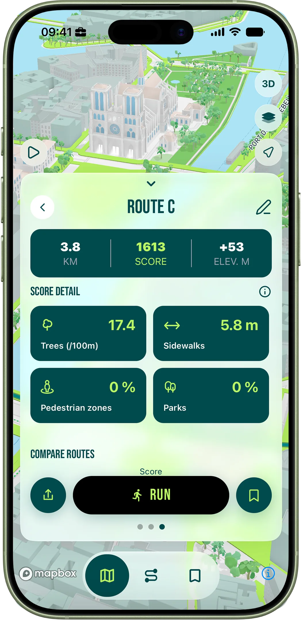
How RunninParis handles elevation

The algorithm currently optimizes for surface quality, pedestrian friendliness, tree density and parks — not elevation. That is intentional: most users want the most pleasant route, not the hardest. But the route map shows elevation visually, and the hill circuits above are easy to build manually: pick a starting address in Montmartre, Belleville or the 5th, set five to eight kilometres, and let the algorithm generate a base. In most cases it will already touch the main climbs, because the scored streets in these neighbourhoods coincide with the wider, more navigable routes up the hill. Repeat the same route three or four times for a repeat session. The elevation data is visible in the route detail screen before you start — use it to pick the hilliest option when you specifically want climbing.


